

-
 Get UpdatesGet notified on education trends, resources, and growth opportunities!
 -

-


 Click it and Unblock the Notifications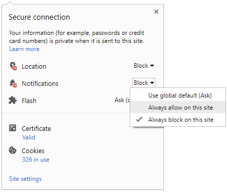

ISRO Free Online Course With Certificate: 12-Day Course On Geospatial Technology
ISRO is offering a 12-Day free online course on Geospatial Technology for Archaeological Studies. The course will give an idea of geospatial technology which can be utilised to monitor natural disasters.

The Indian Space Research Organisation (ISRO) is offering a 12-Day free online course on Geospatial Technology for Archaeological Studies. The course is a part of the Indian Institute of Remote Sensing (IIRS) outreach program. The course will give participants an idea of geospatial technology which can be utilised to monitor natural disasters. The participants will have an understanding of the latest trends in geospatial techniques for archaeological or heritage studies towards the end of the course. The ISRO free online course will be conducted by the Indian Institute of Remote Sensing from May 17 to 28, 2021.

About The ISRO Free Online Course
The ISRO free online course will cover the significant parts of utilising remote sensing, global positioning systems, geographic information system, and internet mapping services for all phases of disaster management like hazard mapping, risk assessment, monitoring, emergency response, and reconstruction including early warning through these topics:
- Geospatial technology for archaeology: Tools and Techniques
- Space-based remote sensing for Archaeological studies
- Ground-based geospatial techniques for archaeological or heritage studies
- Documentation of cultural heritage sites: Case examples
- Low altitude systems for archaeological investigations
- Microwave remote sensing for archaeological studies: Space and Ground-based
- Demonstration on terrestrial laser scanner
- Space-based studies for landscape archaeology
- Advanced image processing based damage assessment of cultural heritage monuments
ISRO Free Online Course: How To Apply
Only institutes that are enrolled with the IIRS through a coordinator designated by the institute can participate in the ISRO free online course. The institute can be registered on the official website by giving significant details such as the organisation's name, PIN code, and personal details. The participants can register themselves by choosing their organisation as the nodal centre.
ISRO Free Online Course: Target Audience
- Experts from the central, state government, or private firms
- NGOs indulged in hydro-meteorological based regional and national projects
- Students and researchers oriented towards research or working in disaster risk reduction activities
ISRO Free Online Course Certificate
The participants will receive an ISRO Certificate dependent on 70 percent attendance upon successfully completing the course. The individuals who want to know more about the course can go through the Course Brochure in detail for more information.
- Block for 8 hours
- Block for 12 hours
- Block for 24 hours
- Don't block

 Continue with Google
- Male
- Female
- Others
- Under 18
- 18 to 25
- 26 to 35
- 36 to 45
- 45 to 55
- 55+